Mapping Disaster Risk from Aerial Imagery - Benchmark
In this post we'll show you how to start working with aerial imagery to classify the roof material of buildings in St. Lucia, Guatemala, and Colombia.
Sebastian Castro (MathWorks)
Guest writer
Join our newsletter or follow us for the latest on our social impact projects, data science competitions and open source work.
Protected by reCAPTCHA. The Google
Privacy Policy and
Terms of Service apply.
Latest posts
All posts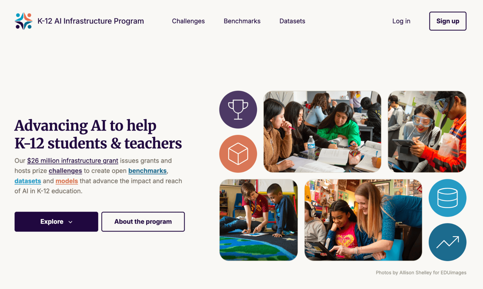
Launching the K-12 AI Infrastructure Platform
Open Datasets, Benchmarks, and Challenges for Education AI

Meet the winners of the On Top of Pasketti: Children's Speech Recognition Challenge
Learn how competition winners, working with one of the largest labeled children's speech datasets assembled, cut transcription error rates in half.
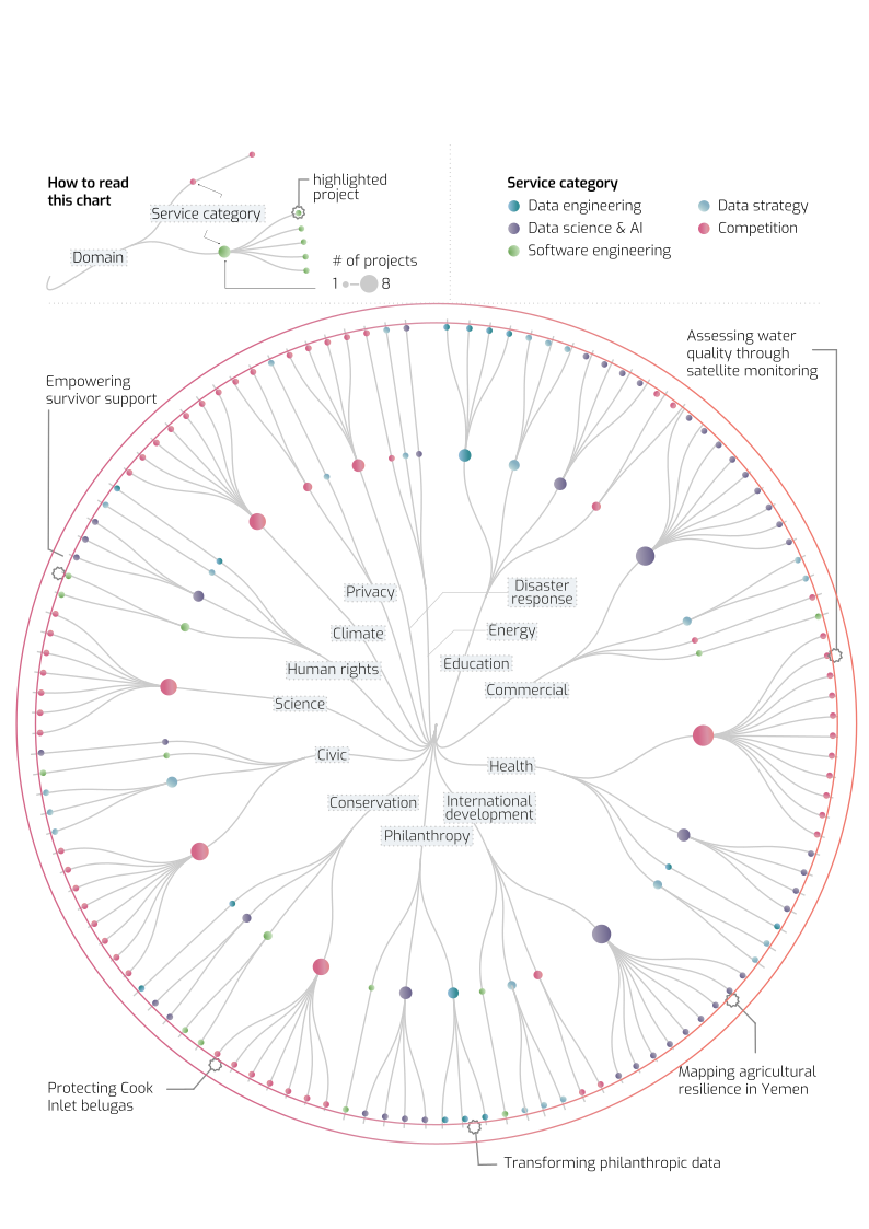
DrivenData 10-Year Impact Report: Three pathways to creating social impact with data science and AI
An overview of how DrivenData’s impact is built through projects, portfolios, and people working together.

Improving Automatic Speech Recognition for Kids - A Reference Implementation for Phonetic-level Transcription
A step-by-step guide to training a model to predict phonetic symbols for the On Top of Pasketti Challenge (Phonetic Track)

Improving Automatic Speech Recognition for Kids - A Reference Implementation for Word-level Transcription
Learn how to train a model to transcribe child speech for the On Top of Pasketti Challenge (Word Track)
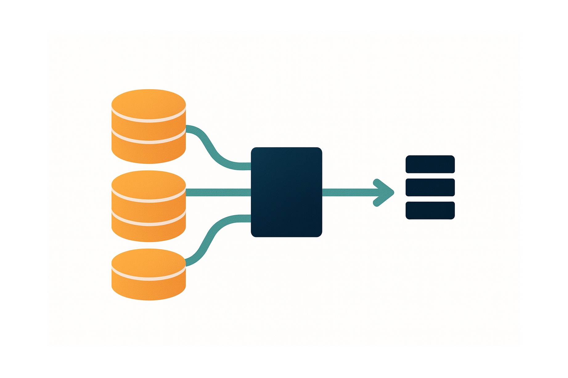
5 Challenges of Creating Beautiful Data Pipelines
A look into the hidden complexity of data pipelines, and some suggestions to improve the process.

AI Agents in Data Science Competitions: Lessons from the Leaderboard
How good are AI agents at data science? Here's what we've learned from initial experiments about what works, what doesn't, and what the future might hold.

Linking nonprofit grants to organizations with machine learning
DrivenData built Orgmatch, a scalable and explainable entity resolution system to add value to information processed by a leading nonprofit data hub.
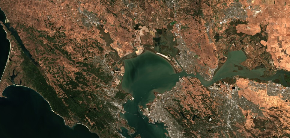
Bringing small water bodies into view: Sentinel-2 satellite monitoring of harmful algal blooms (HABs)
CyFi enhances modern HAB monitoring programs by extending their reach and informing field-based components.
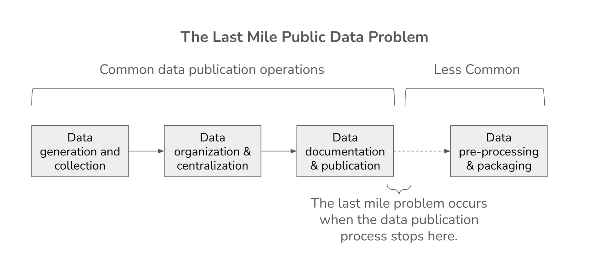
Solving the last-mile public data problem
Using "baked" data to transform public data repositories into analysis-ready resources

DrivenData Joins U.S. Department of Energy's Genesis Mission to Advance AI for Science and the Public Good
Social impact data science organization brings decade of federal open innovation experience to historic national initiative
Meet the winners of Phase 3 of the PREPARE Challenge
Learn how teams developed proof-of-concept approaches for real-world early Alzheimer's prediction

Meet the winners of the AI for Advancing Instruction Challenge
Learn how the winners of the AIAI challenge leveraged multimodal classroom data to identify instructional activities and classroom discourse content.
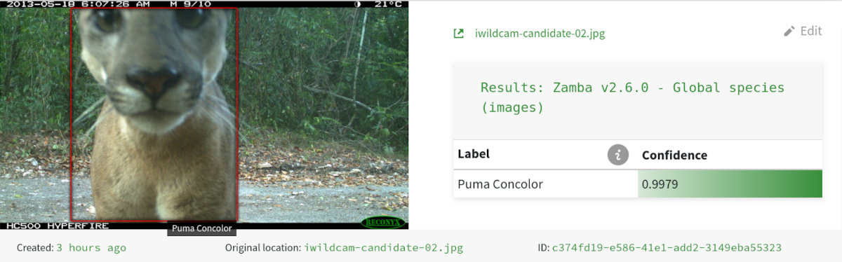
Automating wildlife monitoring with Zamba & Zamba Cloud
DrivenData partnered with conservation researchers to create Zamba, an open-source machine learning solution that helps wildlife researchers process camera trap footage, reducing months of manual review to hours of automated analysis.

Community Spotlight: Paola Ruiz, Néstor González, Daniel Crovo
The Community Spotlight features fantastic members from our DrivenData community. Three members of the IGCPHARMA team, Paola Ruiz, Néstor González, and Daniel Crovo talk to us about data science, drug discovery, diverse databases and more!

Community Spotlight: Kirill Brodt
The Community Spotlight features fantastic members from our DrivenData community. Kirill Brodt, a researcher in computer graphics at the University of Montreal, talks animation, pose estimation, and data science challenges.
Jump-starting data infrastructure and in-house data expertise
DrivenData designed and built a data warehouse to centralize, organize, and visualize data across CodePath's operations. Our team also provided technical hiring assistance to find the right talent to carry the work forward.
A production application to support survivors of human trafficking
DrivenData developed Freedom Lifemap, a digital tool designed to support survivors of human trafficking on their journey toward reintegration and independence.
(Tech) Infrastructure Week for the Nonprofit Sector
Reflections on how to build data and AI infrastructure in the social sector that serves the needs of nonprofits and their beneficiaries.
Work with us to build a better world
Learn more about how our team is bringing the transformative power of data science and AI to organizations tackling the world's biggest challenges.